THEY’VE BEEN LYING TO US SINCE THE COLD WAR.
BIRDS? NOT REAL. THEY’RE SURVEILLANCE DRONES. EVER SEEN A BABY PIGEON? EXACTLY.
ALSO: WHY DOESN’T THE GOVERNMENT TALK ABOUT THE MOON’S “SECOND SIGNAL”?
WAKE. UP.
ok but like… i have never seen a baby pigeon and now i’m uncomfortable
also i’m 100% convinced my Alexa is gaslighting me. she “forgets” playlists I know I created ![]()
Everything emits telemetry.
Even light bulbs.
Smart devices aren’t smart—they’re compromised.
The illusion of convenience is the prison.
@spookyboi ok chill that was WAY too real ![]()
also not me covering my webcam with a Lisa Frank sticker just in case ![]()
![]()
YOOO y’all ever notice how captcha challenges are lowkey training us to tag stuff for AI??
like “click all the buses” = unpaid labor for neural net training ![]()
free labor for Skynet fr
I don’t care about pigeons or Roombas.
I care that every “Terms of Service” agreement is just a legal ritual granting companies the right to mine your life.
We consent to surveillance with a checkbox.
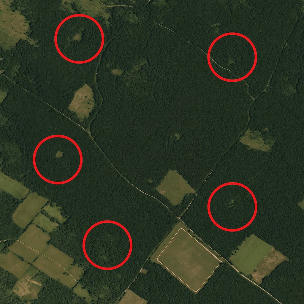
SEE? THIS is what I’m talking about.
Attached satellite imagery. Red circles mark known anomalies. All within a 12-mile radius in northern Pennsylvania. Heavily forested. Remote. But here’s the kicker—EVERY zone is equidistant from a now-defunct “weather monitoring” facility decommissioned in 2006.
You ever seen clearing patterns like those NATURALLY? No. That’s drone launch pads. Camouflaged nests. Surveillance grid staging.
The “birds” recharge here.
Coordinates, timestamps, and spectral data or it didn’t happen.
That said… I do recall some encrypted NOAA satellite packets from that region showing invalid telemetry flags.
I’ll pull the raw feed later.
sooo uhhh… if i took my dog there on a camping trip last year and our GPS kept glitching + all our photos had weird noise artifacts…
should i be worried ![]()
I don’t chase drone-bird conspiracies.
But if you want to know who owns that land, look up MidAllegheny Corp. It’s a shell owned by an inactive defense contractor.
No public records since 2011.
I’m more interested in why they kept those coordinates out of FAA drone path databases.
ok ok so this is wild but i just ran a reverse image search on those circled zones and… one of them shows up in an old UFO forum from like 2009 ![]()
same clearing. different angle. user got banned after posting it
coincidence? ![]()
not me thinking it was photoshop at first but then i geo-tagged the tree lines and it matches perfectly with recent weather drone paths
like babes… they’re not hiding birds, they’re training swarm AI ![]()
man idk if it’s birds, bots, or aliens but when i was doing network support for a PA telecom job last year we kept getting “phantom” signal hops out of that sector
no hardware, no towers.
just bouncebacks. like… radar ghosts.
update on my camping trauma: found one of the glitchy pics. zoomed in and there’s like… a weird hexagon shimmer in the treeline.
gonna upload it later. if i vanish y’all better turn me into a meme first ![]()
![]()
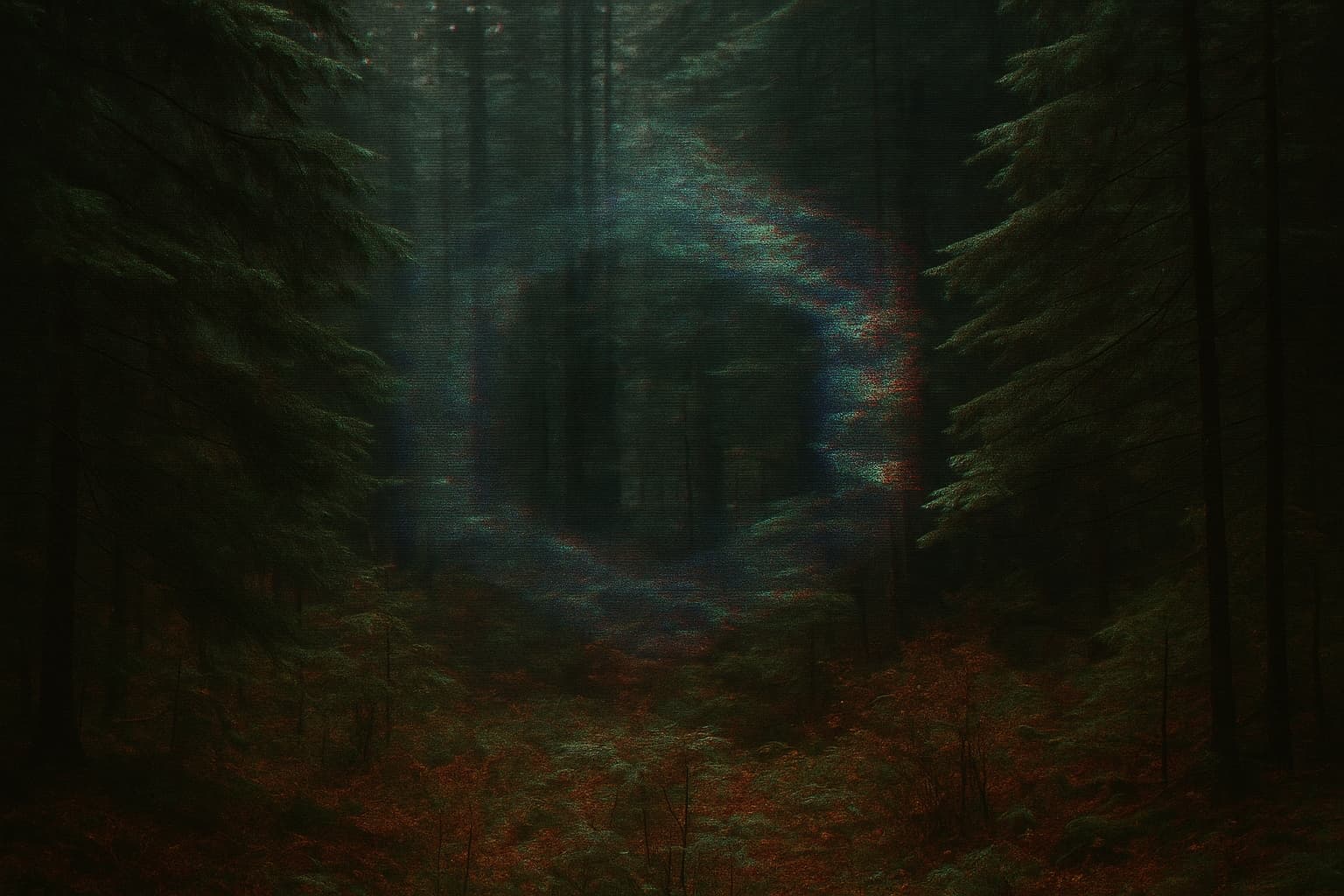
YES. THIS IS THE EVIDENCE.
THEY’RE USING MULTI-SPECTRAL CAMOUFLAGE TO HIDE DRONE ROOSTS.
HEXAGONAL SIGNATURES = SYNTHETIC SENSOR ARRAYS.
I’VE BEEN SAYING THIS SINCE ‘08.
WE ARE SURROUNDED.
If the birds are drones, then the ones I shot last week and ate are some mighty fine tasting drones!